 Wersja polska
 English version
Wawrzaszek A., Aleksandrowicz S., Krupiński M., Drzewiecki W. Influence of Image Filtering on Land Cover Classification when using Fractal and Multifractal Features. PFG Photogrammetrie, Fernerkundung, Geoinformation Jahrgang 2014 Heft 2 (2014), p.101-115
Over the last years, many features describing satellite images have been proposed. In this paper we analyse and compare fractal and multifractal features in the context of the discrimination of the four most common
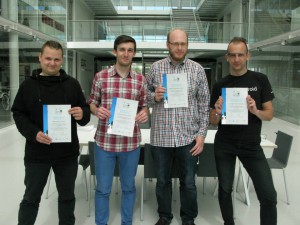
Space App Camp 2014
From 4th to 12th May two of our software developers, Adam Włodarkiewicz and Krzysztof Stopa together with two android developers, Danny Preussler (Grupon) and Johannes Orgis (6Wunderkinder) from Berlin, have been selected to participate

Earth Observation for Gas and Oil: On-shore
This project is dedicated to support European Space Agency and the Oil and Gas Producers EO(OGP EO) sub-committee establish the key geo-information requirement needs of the onshore oil and gas sector throughout the oil
ESA Sentinel 1: Feasibility study of land cover classification based on SAR Sentinel-1 images
The goal of the project is to perform feasibility study of land cover classification based on SAR Sentinel-1 images. Currently used algorithms dedicated to land cover classification on SAR images does not give the

B-First: Implementation of remote sensing data and models in optimizing the localisation of renewable energy sources on the example of biofuel crops with respect to ecological constraints
The Project financed under ESA PECS contract (Plan for European Cooperating States). The main aim is to use satellite images (optical and radar) to determine the optimal location for energy crops, in terms of
European Area Frame Sampling Based on Very High Resolution Images
Initiated in 2007, the Area Frame Sampling Europe subtask of the Seasonal and Annual Change Monitoring Service (SATChMo) Core Service in the geoland2 project delivered its final products in 2012. Three of these are
New platform for webinars
In the frames of the EOPOWER Project new platform for webinars has been created. It enables institutions from different regions to exchange knowledge and experience in fast and low cost way. First test webinars
Drzewiecki W., Wawrzaszek A., Aleksandrowicz S., Krupinski M., Bernat K. Comparison of selected textural features as global content-based descriptors of VHR satellite image. Geoscience and Remote Sensing Symposium (IGARSS), 2013 IEEE International
The paper presents the results of the study of usefulness of selected textural features for describing the content of image chips (1024 by 1024 pixels) cut from WorldView-2 panchromatic images. Several texture analysis techniques
Wawrzaszek A., Krupinski, M. ; Aleksandrowicz S., Drzewiecki W. Fractal and multifractal characteristics of very high resolution satellite images. Geoscience and Remote Sensing Symposium (IGARSS), 2013 IEEE International.
In our work we analyse fractal and multifractal characteristics for description and extraction of information from very high spatial resolution satellite images. In particular, we propose the degree of multifractality as a parameter for
Presentation of the achievements of programmers from Earth Observation Group
On 11 December in Krakow monthly meeting of the Committee of Geoinformatics Polish Academy of Arts and Sciences was held. Artur Nowakowski presented achievements of a group of programmers working in Earth Observation Group. Within two years of