|
|
Winter at the Polish-Slovakian boundary, including
the Tatra Mountains region (the highest part of the Carpatians Mountains,
the boundary of Poland and Slovakia). Data of ALI sensor, the EO-1
satellite, acquainted November 30, 2003. Click the image to enlarge.
|
|
Enlarge to see the border between snow-covered and
snow-free land (snow is marked in red, clouds are white). The water
body in the north part of the image is Baltic Sea, with its snow-free
coast marked with shades of green. Image from ETM+ sensor of the
Landsat 7 satellite, February 22, 2000. Click the image to enlarge.
|
|
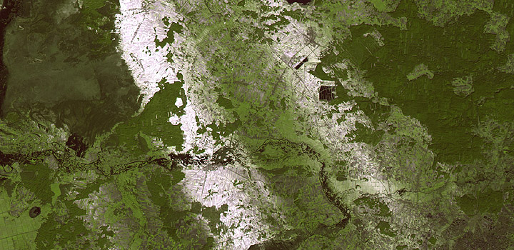
Winter at the Polish-Slovakian. Above the snow
layer only forests and buildings are seen, significantly contrasting
with white background. Roads leading to Zakopane are easily seen.
Image of ETM+ sensor, Landsat 7 satellite, November 29, 1999.
Click the image to enlarge.
|
|
Snow-covered part of the Carpathians and the Sandomierz
Basin on the Christmas Eve of 1999. Image of ETM+ sensor, Landsat
7 satellite. Click the image to enlarge.
|
|
White stripes on the Earth's surface after the
snow showers in mid-February 2002. Image of ETM+ sensor, Landsat
7 satellite. Click the image to enlarge.
|
|
Snow-covered central part of the Vistula river
valley (Poland). Image of ETM+ sensor, Landsat 7 satellite, February
28, 2001. Click the image to enlarge.
|
|
Ice floe in the Szczecin Lagoon, as seen by the
ETM+ sensor of Landsat 7 satellite in mid-February, 2003. Click
the image to enlarge.
|
|
Snow-covered estuary of Vistula river and Vistula
Lagoon (note the ice floe transported by the river into Baltic
Sea). Image of ETM+ sensor, Landsat 7 satellite, February 16,
2003. Click the image to enlarge.
|
|
Snowy landscape of Warsaw on January 8, 2003.
Panchromatic image of ALI sensor on-board EO-1 satellite. Click
the image to enlarge.
|
|
Boundary of the snow cover coincided with the
course of the administrative boundary between Poland and Ukraine.
Snow-free vegetated areas are in red. Image of ETM+ sensor, Landsat
7 satellite, February 19, 2000. Click the image to enlarge.
|
|
|