PL
EN


AKCBK PAN
Go to:
 

Snow Cover extent in Europe


Poland


Daily updated map on Snow Cover Extent in Europe.

Water (ice free)
Land
(snow free)
Ice cover
Snow cover


Read usefull
information

about the map.


Full resolution
(4 km/pixel)


Map is based on the IMS snow analysis, as published by NOAA [more].


Is current winter a typical? How much snow is in Europe, or in my country? Where is the snow?

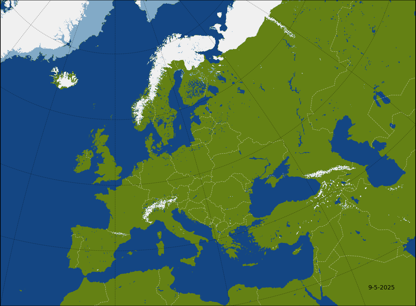
Information presented on this website - i.e. the snow cover map for Europe (above) and plots of snow cover extent (below) - will help you to answer those questions. The information results from satellite monitoring of climate conditions in Poland (and Europe), conducted by Earth Observation Group at Space Research Centre of the Polish Academy of Sciences (CBK PAN).

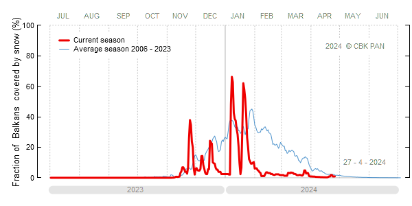
Presented analysis are based on satellite observations, provided by NOAA Interactive Multisensor Snow and Ice Mapping System (IMS). They are daily updated and report snow cover conditions during current winter season (from July to June). On this website you may also find a historical data for past winters and a climatological averages. Based on them you can independently assess how much current winter differs from a typical one.

Why do we care about the snow cower? Climatologists from CBK PAN examine snow cover because its presence influences the energy budget of the atmosphere and the hydrological budget of the environment. Snow fall influences also our daily life - heavy snow fall makes transport difficult, sometimes leading to disruptions in road and air traffic. Moreover, fast melting of snow may increase level of the rivers and even the onset of winter and spring floods.


Balkans

Get high resolution
plot as PDF


Get historical
data
on snow


How to read
the plot
?


© 2010-2023  | Earth Observation Group at CBK PAN
 
Data analysis and web site concept: Andrzej Kotarba
Web site maintenance: Andrzej Kotarba, Adam Włodarkiewicz and Kamil Drejer
Contact info: zoz@cbk.waw.pl


Web site was partialy deweloped under the framework of the following projects:
  GEO Network for Capacity Building - GEONetCab, 2009-2012
  Earth Observation for Economic Empowerment - EOPOWER, 2013-2015
  Framework Partnership Agreement on Copernicus User Uptake - FPCUP, 2022-2025

Logo
Disclaimer: We put our best effort to make this web site as accurate as possible. Nevertheless the web site comes with no warranty to its users. By using this web site and/or data published on this web site you acknowledge, that you are doing this on YOUR OWN risk and responsibility. Acknowledgement: Source data used by this web site (The Interactive Multisensor Snow and Ice Mapping System, or IMS) originates from NOAA servers and are freely available for everyone at http://www.natice.noaa.gov/ims/.