Earthquake in Nepal
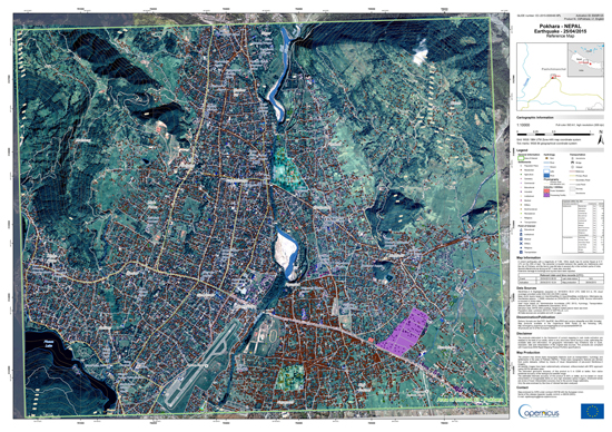
 On April 25, 2015 an earthquake of magnitude 7,9 on the Richter scale struck densely populated areas of Nepal. Crisis Information Centre SRC PAS monitors maps which are being created and supplies Polish Center for International Aid (PCPM) whose rapid response medical team works on site of the event.
There was activated Copernicus Emergency Management Service, which provides maps with information derived from satellite images:
http://emergency.copernicus.eu/mapping/list-of-components/EMSR125
Also Center for Satellite Based Crisis Information (ZKI), service of DLR, published reference maps of Kathmandu:
 Wersja polska
 English version