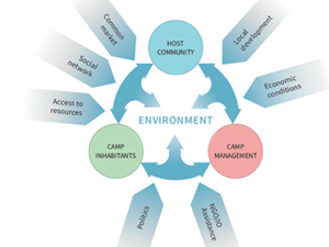
Sobczak-Szelc K. (2024) et al. Navigating environmental fragility: (Mal)coping and adaptation strategies in the socio-environmental system of the Mtendeli Refugee Camp, Tanzania
The study conducts a systems analysis of coping and adaptation strategies in Tanzanian refugee camps, focusing on the Mtendeli camp as a case study. It explores the environmental changes during the stages of the
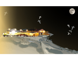
Bałazy K. et al. (2024) Illuminating the Arctic: Unveiling seabird responses to artificial light during polar darkness through citizen science and remote sensing
Artificial light at night (ALAN) has global impacts on animals, often negative, yet its effects in polar regions remains largely underexplored. These regions experience prolonged darkness during the polar night, while human activity and
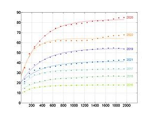
Domingo-Marimon C. et al. (2024) Developing an early warning land degradation indicator based on geostatistical analysis of Ecosystem Functional Types dynamics
Identifying and quantifying ecosystem degradation and recovery is of critical importance for ecosystem health, biodiversity, food security and the livelihoods of local communities. Remote sensing datasets and techniques, particularly land cover maps, provide crucial

Gromny E. at al., (2024) Remote sensing insights into land cover dynamics and socio-economic Drivers: The case of Mtendeli refugee camp, Tanzania (2016–2022)
The purpose of this article is to present the scope and the dynamics of the environmental changes unfolded in the vicinity of Mtendeli refugee camp. It presents a new method, which combines geospatial analysis
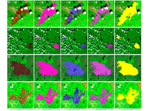
Milczarek, M., at al (2023). Object- Versus Pixel-Based Unsupervised Fire Burn Scar Mapping under Different Biogeographical Conditions in Europe
Wildfire detection and mapping is crucial for managing natural resources and preventingfurther environmental damage. In this study, we compared two methods of mapping burn scarsusing Sentinel-2 satellite imagery, a pixel-based approach and an object-based
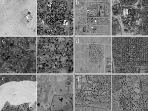
Jenerowicz M., Wawrzaszek A., Drzewiecki W., Krupiński M., Aleksandrowicz S. (2019), Multifractality in Humanitarian Applications: A Case Study of Internally Displaced Persons/Refugee Camps, IEEE Journal of Selected Topics in Applied Earth Observations and Remote
The coordination of humanitarian relief is always difficult due to a lack of data required for management and planning. Remote sensing imagery can be an important source of information about the in-situ situation, notably,
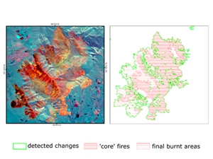
Woźniak E., Aleksandrowicz S. (2019), Self-Adjusting Thresholding for Burnt Area Detection Based on Optical Images, Remote Sensing
Mapping of regional fires would make it possible to analyse their environmental, social and economic impact, as well as to develop better fire management systems. However, automatic mapping of burnt areas has proved to
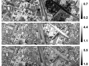
Krupiński M., Wawrzaszek A., Drzewiecki W., Aleksandrowicz S., Jenerowicz M. (2019), Multifractal Parameters for Spectral Profile Description, IGARSS 2019
Hyperspectral data provides huge amount of detailed information about spectral properties of the objects. In the era of fast data volume enlargement, it is necessary to develop methods and algorithms which are capable for
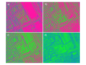
Aleksandrowicz S., Wawrzaszek A., Jenerowicz M., Drzewiecki W. and Krupiński M. (2019), Local Multifractal Description of Bi-Temporal VHR Images, 2019 10th International Workshop on the Analysis of Multitemporal Remote Sensing Images (MultiTemp), Shanghai, China, 2019, pp. 1-3. doi: 10.1109/Multi-Temp.2019.8866963
In this work we apply local multifractal formalism to spectral bands of bi-temporal Very High Resolution (VHR) images. Analysis of the local multifractal description and its changes between images acquired in two points in
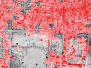
Jenerowicz M., Wawrzaszek A., Krupiński M., Drzewiecki W., Aleksandrowicz S. (2019), Aplicability of Multifractal Features as Descriptors of the Complex Terrain Situation in IDP/Refugee Camps, IGARSS 2019
This paper presents the preliminary results of the complex terrain situation description with the utility of multifractal features. The analysis was done for two samples of Internally Displaced Person/Refugee camps (Ifo, Daadab in Kenya/Al
 English version