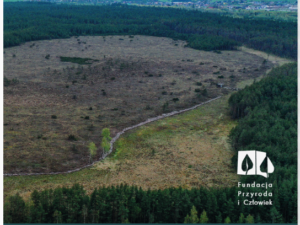
Satelitarny monitoring roślinności rezerwatu w latach 1984-202
This study explores how cultural ecosystem services (CES) are shaped in public urban green spaces (PUGS). Using a qualitative ‘walk and talk’ approach with 27 experts across five Warsaw PUGS, authors examined the co-production

‘This is my magical place here’. Linking cultural ecosystem services and landscape elements in urban green spaces
This study explores how cultural ecosystem services (CES) are shaped in public urban green spaces (PUGS). Using a qualitative ‘walk and talk’ approach with 27 experts across five Warsaw PUGS, authors examined the co-production
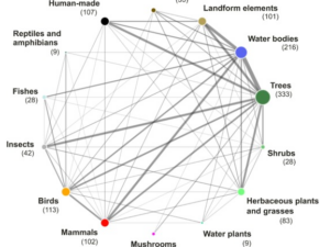
‘This is my magical place here’. Linking cultural ecosystem services and landscape elements in urban green spaces
This study explores how cultural ecosystem services (CES) are shaped in public urban green spaces (PUGS). Using a qualitative ‘walk and talk’ approach with 27 experts across five Warsaw PUGS, authors examined the co-production
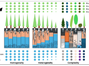
Beierkuhnlein C. (2025) et al. Towards a comprehensive geodiversity – biodiversity nexus in terrestrial ecosystems
The study address the need for an integrated approach to managing complex natural systems by linking geodiversity and biodiversity. These elements interact across scales, influencing climate and human land use while underpinning ecosystem services.
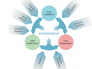
Sobczak-Szelc K. (2024) et al. Navigating environmental fragility: (Mal)coping and adaptation strategies in the socio-environmental system of the Mtendeli Refugee Camp, Tanzania
The study conducts a systems analysis of coping and adaptation strategies in Tanzanian refugee camps, focusing on the Mtendeli camp as a case study. It explores the environmental changes during the stages of the
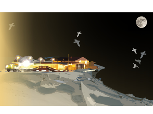
Bałazy K. et al. (2024) Illuminating the Arctic: Unveiling seabird responses to artificial light during polar darkness through citizen science and remote sensing
Artificial light at night (ALAN) has global impacts on animals, often negative, yet its effects in polar regions remains largely underexplored. These regions experience prolonged darkness during the polar night, while human activity and

Domingo-Marimon C. et al. (2024) Developing an early warning land degradation indicator based on geostatistical analysis of Ecosystem Functional Types dynamics
Identifying and quantifying ecosystem degradation and recovery is of critical importance for ecosystem health, biodiversity, food security and the livelihoods of local communities. Remote sensing datasets and techniques, particularly land cover maps, provide crucial
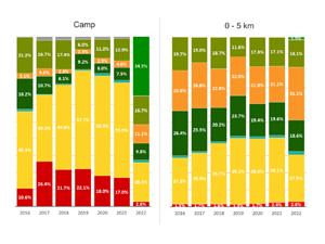
Gromny E. et al., (2024) Remote sensing insights into land cover dynamics and socio-economic Drivers: The case of Mtendeli refugee camp, Tanzania (2016–2022)
The purpose of this article is to present the scope and the dynamics of the environmental changes unfolded in the vicinity of Mtendeli refugee camp. It presents a new method, which combines geospatial analysis
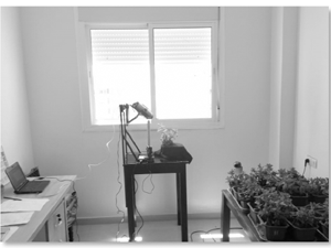
Taia H. et al. (2024) Using hyperspectral reflectance to evaluate the impact of irrigation and fertilization on mint
In agriculture, water and fertilizer are two limiting elements of plant growth. Indeed, the lack or the excess of one of them disturbs the yields in terms of quality and quantity. Optimal irrigation/fertilization and
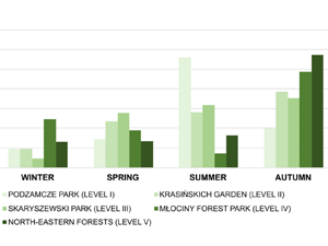
Kulczyk S. et al. (2024) Nature in urban green spaces: main attractor or nice background? Drivers and dynamics of cultural ecosystem services provision
Urban parks and forests are important providers of cultural ecosystem services (CES) for the majority of the global population. Data from diverse sources are needed to reflect both ecological and social aspects of CES
 Wersja polska
 English version