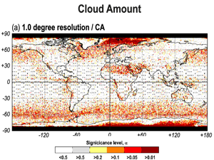
Kotarba, A.Z. (2022) Errors in global cloud climatology due to transect sampling with the CALIPSO satellite lidar mission
Although cloud profiling lidars provide the most accurate data on cloud amount (CA), cloud top height (CTH) and cloud optical thickness (COT), they only sample cloud fields along a one-dimensional transect. This approach introduces
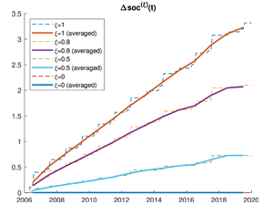
Diele F., Luiso I., Marangi C., Martiradonna A., Woźniak E. (2022) Evaluating the impact of increasing temperatures on changes in Soil Organic Carbon stocks: sensitivity analysis and non-standard discrete approximation
The SOC change index, defined as the normalized difference between the actual Soil Organic Carbon and the value assumed at an initial reference year, is here tailored to the RothC carbon model dynamics. It
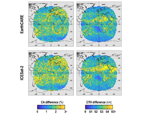
Kotarba, A. Z. (2022) Impact of the revisit frequency on cloud climatology for CALIPSO, EarthCARE, Aeolus, and ICESat-2 satellite lidar missions
Space profiling lidars offer a unique insight into cloud properties in Earth’s atmosphere and are considered the most reliable source of total (column-integrated) cloud amount (CA), and true (geometrical) cloud top height (CTH). However,
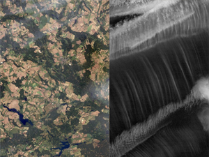
Kotarba, A.Z, Nguyen Huu, Ż. (2022) Accuracy of cirrus detection by surface-based human observers
The longest cirrus time series are ground-based, visual observations captured by human observers [synoptic observations (SYNOP)]. However, their reliability is impacted by an unfavorable viewing geometry (cloud overlap) and misclassification due to low cloud
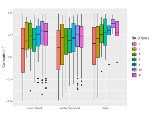
Bojanowski J., Sikora S., Musiał J., Woźniak E., Katarzyna Dąbrowska-Zielińska K., Slesiński P., Milewski T., Łączyński A. (2022), Integration of Sentinel-3 and MODIS Vegetation Indices with ERA-5 Agro-meteorological Indicators for Operational Crop Yield Forecasting
Timely crop yield forecasts at national level are substantial to support food policies, to assess agricultural production and to subsidize regions affected by food shortage. This study presents an operational crop yield forecasting system
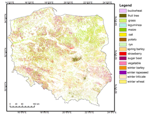
Woźniak E., Rybicki M., Kofman W., Aleksandrowicz S., Wojtkowski C., Lewiński S., Bojanowski J., Musiał J., Milewski T., Slesiński P., Łączyński A. (2022), Multi-temporal phenological indices derived from time series Sentinel-1 images to country-wide crop classification
Crop classification is a crucial prerequisite for the collection of agricultural statistics, efficient crop management, biodiversity control, the design of agricultural policy, and food security. Crops are characterized by significant change during the growing
 Wersja polska
 English version