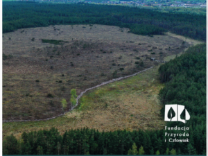
Satelitarny monitoring roślinności rezerwatu w latach 1984-202
This study explores how cultural ecosystem services (CES) are shaped in public urban green spaces (PUGS). Using a qualitative ‘walk and talk’ approach with 27 experts across five Warsaw PUGS, authors examined the co-production

‘This is my magical place here’. Linking cultural ecosystem services and landscape elements in urban green spaces
This study explores how cultural ecosystem services (CES) are shaped in public urban green spaces (PUGS). Using a qualitative ‘walk and talk’ approach with 27 experts across five Warsaw PUGS, authors examined the co-production

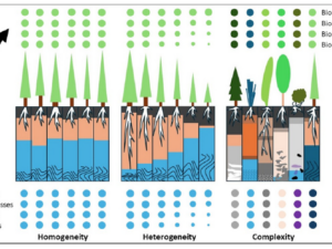
Beierkuhnlein C. (2025) et al. Towards a comprehensive geodiversity – biodiversity nexus in terrestrial ecosystems
The study address the need for an integrated approach to managing complex natural systems by linking geodiversity and biodiversity. These elements interact across scales, influencing climate and human land use while underpinning ecosystem services.

Domingo-Marimon C. et al. (2024) Developing an early warning land degradation indicator based on geostatistical analysis of Ecosystem Functional Types dynamics
Identifying and quantifying ecosystem degradation and recovery is of critical importance for ecosystem health, biodiversity, food security and the livelihoods of local communities. Remote sensing datasets and techniques, particularly land cover maps, provide crucial

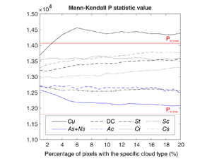
Wojciechowska, I., Kotarba, A. Z., & Żmudzka, E. (2023). Cloud type frequency over Poland (2003–2021) revealed by independent satellite-based (MODIS) and surface-based (SYNOP) observations
Recent studies have identified several statistically significant trends in cloud genera frequency over Poland. Notably, there has been an increase in high and convective clouds, along with a decrease in Stratus, Altostratus and Nimbostratus.

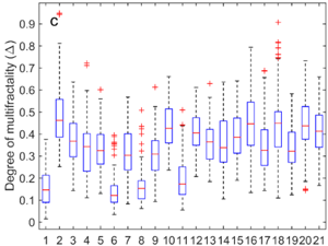
Wawrzaszek A., Drzewiecki W., Krupiński M., Jenerowicz M., Aleksandrowicz S. (2021), Multifractal Features for Land Use Classification
In our work, we analyze multifractal parameters for the description and classification of a 2056 subsets of aerial images representing 21 land-use classes. In particular, we consider the degree of multifractality, estimated with different
 Wersja polska
 English version