 Wersja polska
 English version
Kotarba A. (2020), Calibration of global MODIS cloud amount using CALIOP cloud profiles
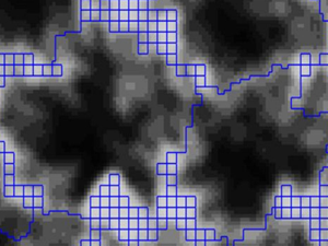
The Moderate Resolution Imaging Spectroradiometer (MODIS) cloud detection procedure classifies instantaneous fields of view (IFOVs) as either “confident clear”, “probably clear”, “probably cloudy”, or “confident cloudy”. The cloud amount calculation requires quantitative cloud fractions
Dziob D., Krupiński M., Woźniak E., Gabryszewski R. (2020), Interdisciplinary Teaching Using Satellite Images as a Way to Introduce Remote Sensing in Secondary School
This article aims to meet two needs: (i) the need for skilled workers and students in the area of remote sensing and (ii) the need to make school science interesting for students. This article
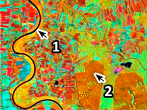
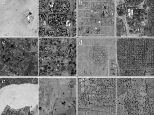
Belcore E., Piras M., Woźniak E. (2020), Specific alpine environment land cover classification methodology: Google Earth Engine processing for Sentinel-2 data
Land Cover (LC) plays a key role in many disciplines and its classification from optical imagery is one of the prevalent applications of remote sensing. Besides years of researches and innovation on LC, the
Belcore E., Wawrzaszek E., Woźniak E., Grasso N., Piras M. (2020), Individual Tree Detection from UAV Imagery Using Hölder Exponent
This article explores the application of Hölder exponent analysis for the identification and delineation of single tree crowns from very high-resolution (VHR) imagery captured by unmanned aerial vehicles (UAV). Most of the present individual
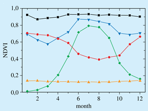
Woźniak E., Gabryszewski R., Dziob D. (2020), Remote sensing and electromagnetic wave behaviour to measure vegetation phenology with physics
Interdisciplinary models of teaching have been present in education systems for at least 30 years. The idea of the interdisciplinarity is to show students the contextualisation of subject knowledge, its relation to real-life problems
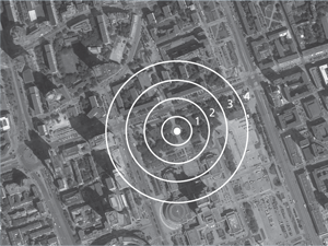
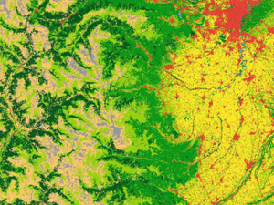
Szulkin M., Garroway C. J., Corsini M., Kotarba A. Z., Dominoni D. (2020), How to Quantify Urbanization When Testing for Urban Evolution?
Urban Evolutionary Biology fills an important knowledge gap on wild organismal evolution in the urban environment, whilst offering a novel exploration of the fast-growing new field of evolutionary research. The growing rate of urbanization
FPCUP
FPCUP – Caroline Herschel Framework Partnership Agreement. Główne cele projektu to: promowanie wykorzystania aplikacji i usług opartych o Obserwacje Ziemi wsparcie rozwoju europejskiego przemysłu kosmicznego i maksymalizacja szans dla europejskich przedsiębiorstw w zarezie opracowania
Jenerowicz M., Wawrzaszek A., Drzewiecki W., Krupiński M., Aleksandrowicz S. (2019), Multifractality in Humanitarian Applications: A Case Study of Internally Displaced Persons/Refugee Camps, IEEE Journal of Selected Topics in Applied Earth Observations and Remote
The coordination of humanitarian relief is always difficult due to a lack of data required for management and planning. Remote sensing imagery can be an important source of information about the in-situ situation, notably,
First Newsletter of MAIL project
The first Newsletter of MAIL (Identifying Marginal Lands in Europe and strengthening their contribution potentialities in a CO2 sequestration strategy,) is available online. In the newsletter you may find more details about project goals,
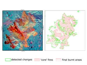
Woźniak E., Aleksandrowicz S. (2019), Self-Adjusting Thresholding for Burnt Area Detection Based on Optical Images, Remote Sensing
Mapping of regional fires would make it possible to analyse their environmental, social and economic impact, as well as to develop better fire management systems. However, automatic mapping of burnt areas has proved to